There is a stretch of forested ridgeline just east of Issaquah, Washington, where you can stand on a muddy trail at 2,500 feet and hear nothing but the tapping of a pileated woodpecker against old-growth bark. Thirty-five miles from downtown Seattle’s glass towers, the Tiger Mountain Trail System sprawls across nearly 14,000 acres of state forest, offering one of the most complex and rewarding trail networks in the Pacific Northwest. It is a place where century-old logging artifacts rust quietly beneath sword ferns, where paragliders launch from grassy knobs into the Cascade foothills’ updrafts, and where a before-work conditioning hike can leave you breathless in more ways than one.
The Tiger Mountain Trail System is not a single path. It is a living, evolving web of interconnected routes — hiking trails, mountain biking circuits, old railroad grades, and fire roads — that together form something far greater than the sum of their parts. And yet, for all its popularity among locals, Tiger Mountain remains surprisingly underappreciated by visitors who drive right past it on Interstate 90, eyes fixed on the higher peaks to the east.
That’s their loss.
The Lay of the Land: Understanding Tiger Mountain’s Geography
Tiger Mountain is not one peak but several. The main ridge runs roughly northwest to southeast for about six miles, with four principal summits strung along it like knots on a rope. East Tiger Mountain, the highest at 3,004 feet, anchors the eastern end and is topped by radio towers that blink red against overcast skies. Moving west, the ridge descends and rises through Middle Tiger at 2,607 feet before reaching the three peaks of West Tiger — West Tiger 1 (2,948 feet), West Tiger 2 (2,757 feet), and West Tiger 3 (2,557 feet).
Together, these summits belong to a chain of Cascade Range foothills known locally as the “Issaquah Alps,” a name coined in the 1970s by the legendary hiking guide author and conservationist Harvey Manning. The Issaquah Alps also include Cougar Mountain and Squak Mountain, but Tiger is the largest and most trail-rich of the group, with over 41 miles of designated trails winding through its forests and across its ridges.
The underlying geology tells a story that stretches back 45 million years. The mountain’s bedrock is composed primarily of the Eocene-age Tiger Mountain Formation — sandstones, siltstones, and minor conglomerates that were once sediments deposited along ancient coastal environments. The Pleistocene glaciers that later carved Puget Sound also sculpted Tiger Mountain’s steep flanks, leaving behind talus caves that rank among the largest in Washington state, unstable cliffs at places like Yah-er Wall, and the gentle depressions that now hold Tradition Lake and Round Lake at the mountain’s western base.
These two lakes, sitting on Tradition Plateau at just 470 feet of elevation, serve as the gateway to the trail system for most visitors. Sedge meadows and wetlands ring the 16-acre Tradition Lake, making it a stopover for migratory birds and a year-round home for resident waterfowl including mallard, gadwall, and wood ducks. It is a remarkably gentle introduction to a mountain that gets progressively wilder the deeper you go.
A History Written in Stumps and Steel Cable
No honest account of Tiger Mountain can skip its logging past, because that history is literally embedded in the trails beneath your boots. Many of the routes that hikers and mountain bikers now use were carved by the timber industry, and the remnants of that era are everywhere if you know where to look.
Initial settler accounts from the 1860s and 1870s described the mountain as a rugged, timber-rich expanse that isolated the fertile Issaquah Valley lowlands. Access was limited until coal discoveries prompted rudimentary surveys and the arrival of railroads in the 1880s. But it was the early twentieth century that truly transformed Tiger Mountain. The Wood & Iverson logging company, established in 1912 and based in the small community of Hobart, acquired significant timberlands from Weyerhaeuser in 1920 and launched large-scale operations throughout the decade.
The old-growth forests of Douglas fir and western red cedar fell at industrial speed. Steam hoists hauled massive logs down slopes. A cog railroad — reportedly one of the steepest in the country during its years of operation — carried timber off the mountain. Today, the West Tiger Railroad Grade Trail follows sections of that very route, and guided history hikes led by the Issaquah Alps Trails Club still stop at rusting artifacts and old camp sites along the way. At a spot called Fred’s Corner, a trail sign marks what was once the site of a high logging camp at 2,000 feet. The camp is completely overgrown now, but dedicated explorers occasionally bushwhack through the brush to find old relics a couple hundred feet below the trail.
By the mid-twentieth century, Tiger Mountain was a patchwork of private and public lands being clearcut at a rapid pace. Beyond the logging, the mountain had become a magnet for less savory activities — motorcycle riding through the mud, illegal dumping, target shooting at anything that moved or didn’t, and the abandonment of stolen vehicles. It was, by most accounts, a beautiful place being treated very badly.
The turning point came in 1976, when Harvey Manning began writing about the Issaquah Alps with the kind of passionate, irreverent prose that could turn a mud-splattered foothill into a cause worth fighting for. His writings attracted a community of hikers and conservationists who shared information about trails, viewpoints, waterfalls, and special places on Tiger, Squak, and Cougar Mountains. In 1979, they formalized their efforts by establishing the Issaquah Alps Trails Club.
The results of their advocacy were transformative. In 1981, the Washington Department of Natural Resources acquired lands to establish Tiger Mountain State Forest, encompassing 13,745 acres for multiple-use management that would balance timber production with public access and ecological protection. Then, in 1989, the West Tiger Mountain Natural Resources Conservation Area was created, setting aside 3,916 acres on the western slopes to prioritize the preservation of old-growth forests, wetlands, and wildlife habitats. The NRCA, co-managed by DNR and the City of Issaquah, emphasizes low-impact recreation, scientific research, and environmental education.
Bill Longwell, an original club member who spent more time on the Issaquah Alps than perhaps anyone else, oversaw the construction of the 16-mile Tiger Mountain Trail — an enormous undertaking that gave the system its backbone. A bronze statue of Harvey Manning now stands in an Issaquah park, watching over the town that sits in the shadow of the mountains he helped save.
The Trails: From Family Strolls to All-Day Epics
The beauty of the Tiger Mountain Trail System is its range. There is something here for the parent pushing a stroller, the trail runner chasing a personal best, the mountain biker looking for flow, and the backpacker in training who needs 3,000 feet of vertical gain before dinner.
Tradition Plateau and the Gentle Start
Most newcomers begin at the High Point Trailhead, accessible from Exit 20 off I-90. From here, the Tradition Lake Loop offers an easy, mostly flat walk through wetlands and second-growth forest. Interpretive displays and an education shelter make this an excellent outdoor classroom, and the accessible trail is popular with school groups from across the Puget Sound region. Round Lake, just two acres but rich with forested wetlands of Oregon ash and black cottonwood, sits nearby. These low-elevation trails are hikeable year-round, and they provide a gentle warm-up for the steeper terrain above.
The Tiger Mountain Trail (TMT)
The spine of the entire system is the Tiger Mountain Trail, commonly known by its initials, the TMT. Running approximately 16 miles from the High Point Trailhead in the north to Tiger Mountain Road in the south, the TMT traverses the full length of the mountain, passing through varied terrain and different types of forest vegetation. It crosses the flanks of all the major peaks without actually summiting any of them, instead threading through some of the most remote and least-visited terrain on the mountain.
Highlights along the TMT include a large glacial erratic boulder, the lush vegetation of Many Creeks Valley where seasonal streams create pockets of extraordinary greenery, and Custer’s Bridge — the approximate midpoint of the trail and arguably the most remote spot in the entire Tiger Mountain system in terms of distance from any trailhead. At Manning’s Reach, a small bench offers room for one or two hikers to sit and catch a minimal but precious view through the trees to the lowlands below, though encroaching tree growth threatens to close that window entirely.
The TMT is rated as difficult due to its length and cumulative elevation gain of roughly 2,500 feet. Most through-hikers arrange a car shuttle, starting at the southern end and hiking north. The trail is well-signed at named junctions — Millan’s Crossing, Pete’s Pass, Paul’s Cove, Zeig’s Zag — each with its own character and each a reminder that this trail was built and maintained by people who loved it enough to name every turn.
West Tiger Summits and the Cable Line
For those who want summit views and a serious workout, the West Tiger peaks deliver. West Tiger 3 is the most popular destination on the entire mountain, drawing crowds of conditioning hikers and trail runners year-round. The West Tiger 3 Trail offers a well-maintained route to the top, while the infamous Cable Line provides a steeper, rougher, more direct assault. The Cable Line is exactly what it sounds like — a trail so steep that old cables protrude from the eroded ground in places, looking almost like hand lines. Decades of heavy foot traffic have gouged deep ruts and braided alternate paths through the hillside. Going up is hard; going down is harder on the knees. Locals love it.
From the summit of West Tiger 1, on a clear day, views extend to Seattle’s skyline, the Olympic Mountains, and the massive white dome of Mount Rainier rising above everything to the south. The summit ridge connecting the three West Tiger peaks supports sensitive meadow plant communities that are carefully protected within the NRCA.
Poo Poo Point and the Chirico Trail
The trail system’s most whimsically named destination is also one of its most spectacular. Poo Poo Point — named for the sound of steam whistles that once echoed from logging operations in the valley below — is a grassy knob on the shoulder of West Tiger Mountain that has become one of the premier paragliding and hang gliding launch sites in the Pacific Northwest. The Chirico Trail climbs steadily up the forested mountainside for about 4.1 miles with 1,637 feet of elevation gain, arriving at a clearing where colorful gliders regularly lift off into the sky. On weekends, the trailhead parking lot fills before mid-morning.
Mountain Biking on East Tiger
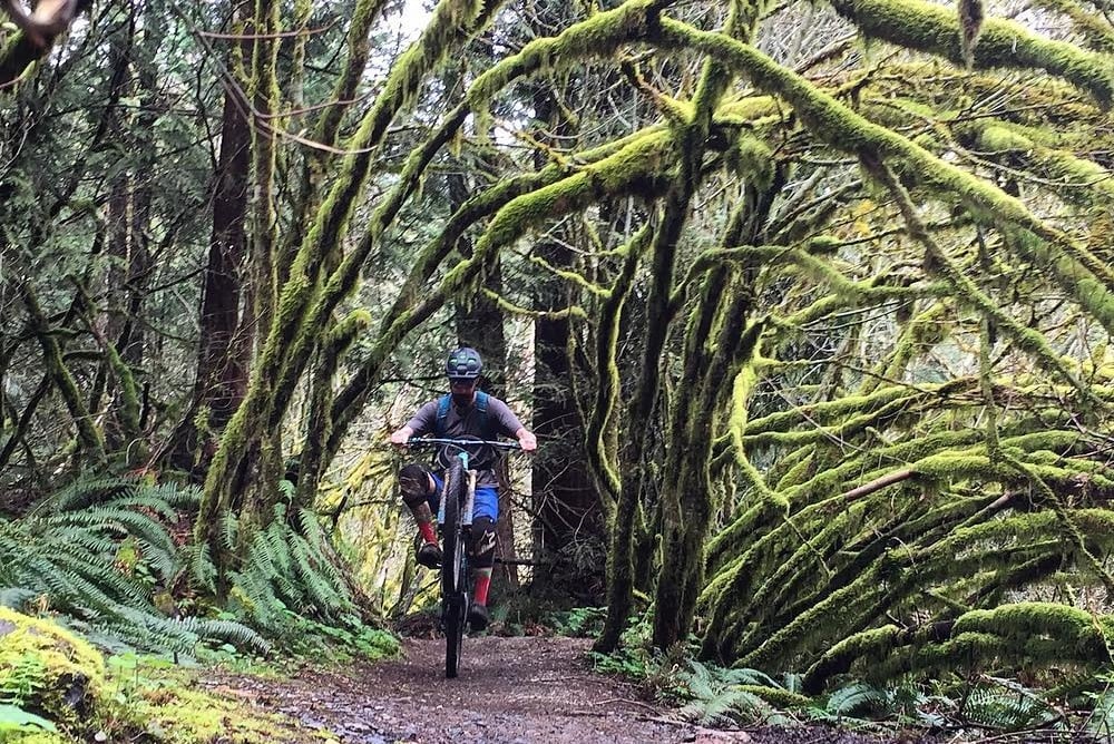
The eastern side of Tiger Mountain has been developed into a dedicated mountain biking network, with trails like Masterlink, Joyride, Northwest Timber, Silent Swamp, Preston Railroad Grade, and Predator offering everything from mellow beginner loops to technical descents. The Evergreen Mountain Bike Alliance has been instrumental in building and maintaining these trails, and a major improvement project is currently underway to expand and enhance the bicycle trail system. The trails are directional for bikes, so hikers should stay alert for riders, particularly on downhill sections around blind corners.
The Wildlife You Might (and Might Not) See
Tiger Mountain’s relatively low elevation and proximity to urban areas might suggest a nature-lite experience, but the reality is richer than most visitors expect. The forest habitat supports a surprisingly diverse cast of wildlife. Blacktail deer are common. Black bears wander the slopes. Coyotes call from the ridgelines. Elk have been documented in the area, and red-tailed hawks, osprey, barred owls, pygmy owls, and pileated woodpeckers patrol the canopy.
And then there are the cougars — the mountain’s namesake neighbors, given that Cougar Mountain next door had already claimed that name. Cougar sightings are reported nearly every year on Tiger Mountain, and occasional warnings are posted at trailheads. The last reported cougar shooting was in 1999, but these big cats remain a quiet, largely unseen presence in the forest. Knowing they are out there adds a certain electric quality to solo hikes in the quieter reaches of the TMT.
The streams that carve through steep ravines on the mountain’s lower slopes support salmon populations, a remarkable ecological fact given how close the mountain sits to suburban development. Riparian zones thick with salmonberry and devil’s club protect the waterways, while the lakes on Tradition Plateau provide critical habitat for migratory and resident waterfowl alike.
The Tension Between Working Forest and Public Playground
Tiger Mountain exists in a state of perpetual tension that is both its defining characteristic and its greatest challenge. It is officially a working state forest, managed by DNR to generate sustainable revenue for public services — including schools, universities, and prisons — through timber production, biomass byproducts, and communication tower leases. Logging is not an unfortunate side effect of the mountain’s management. It is the stated purpose.
This means that hikers who come to Tiger Mountain for the solitude of old forest will periodically encounter the reality of modern timber harvest. Recent logging auctions — including the 108-acre Basaltamuch sale in 2020 and the 97-acre Tree Tip sale in 2023 — have cleared significant patches of forest on the upper slopes, visibly altering the landscape. Reforestation follows, with Douglas fir seedlings planted at roughly 302 per acre, but the “Sleep, Creep, Leap” growth pattern means those seedlings won’t resemble a forest for many years.
The debate over logging on Tiger Mountain is passionate and ongoing. The Legacy Forest Defense Coalition and the Issaquah Alps Trails Club have long advocated for greater protections, while DNR maintains that sustainable forestry practices, certified by both the Sustainable Forestry Initiative and the Forest Stewardship Council, ensure the long-term health of the forest. It is a conversation without easy answers, playing out in real time on a mountain that hundreds of people visit every week.
Practical Matters: Getting There and What You Need to Know
The Tiger Mountain Trail System is accessed via several trailheads off Interstate 90 and State Route 18. The High Point Trailhead (Exit 20 off I-90) is the primary entry point for the West Tiger Mountain NRCA and the northern terminus of the TMT. The Tiger Summit Trailhead off SR-18 provides access to hiking, horseback riding, and mountain biking trails, though it has been undergoing a major renovation and expansion of its parking lot, with completion anticipated in spring 2026. The Preston Trailhead off SR-18 serves the mountain biking network on the eastern side.
A Discover Pass is required for vehicle access to recreation sites. Dogs are allowed on leash. Garbage service is not provided at any trailhead, so pack out everything you bring in. The trails are day-use only — no overnight camping is permitted.
The mountain’s lower elevation means it is hikeable year-round, though conditions vary dramatically by season. Summer brings dry trails, dusty fire roads, and crowded parking lots. Winter brings mud, occasional snow at higher elevations, and the kind of solitude that makes Tiger feel less like a suburban trail system and more like actual wilderness. The sweet spot for many regulars is spring and fall, when wildflowers or autumn foliage line the trails and the crowds thin just enough to hear the forest breathe.
Why Tiger Mountain Matters
In a region blessed with volcanic giants, alpine lakes, and genuine wilderness, it would be easy to dismiss Tiger Mountain as a consolation prize — the hike you do when you don’t have time to drive to the real mountains. That would be a mistake.
Tiger Mountain matters precisely because of where it is. It is the mountain that hundreds of thousands of people in the greater Seattle metropolitan area can reach in 30 minutes. It is the place where children take their first hikes, where trail runners log their weekday miles, where mountain bikers learn to ride singletrack, and where climbers headed for Rainier or Baker build the legs that will carry them above treeline. It is the outdoor classroom where school groups learn about wetland ecology and glacial geology. It is the forest where old logging history and modern conservation collide in ways that force uncomfortable but necessary conversations about how we use public land.
Harvey Manning understood this when he gave the Issaquah Alps their grandiose name. The joke was that these weren’t really alps at all — just modest, logged-over foothills. But Manning knew that naming them as something worthy of protection was the first step toward making them so. The 41 miles of trails, the conservation areas, the volunteer maintenance crews, the guided history hikes, and the ongoing debates about logging are all part of his legacy.
Tiger Mountain is not pristine. It is scarred, second-growth, logged, re-logged, bisected by power lines, buzzed by highway noise at its lower elevations, and crawling with people on sunny weekends. It is also stunningly beautiful, ecologically vital, historically fascinating, and irreplaceable. It is, in other words, a real place — messy, complicated, and absolutely worth every step.