

On March 8, 1970, Bernie Whitebear led 100+ Native Americans and supporters carrying sandwiches, cooking utensils, and sleeping bags toward Fort Lawton’s gates. They were met by 40-member deployment of 392nd Military Police Company decked in riot gear. Protesters were dragged to trucks, manhandled (though military denied using excessive force), booked in jail. But it was too late. Public sympathy and attention—fueled by presence of protester Jane Fonda—was already fixed on tumult over these 1,100 acres.
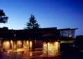
The occupation lasted four months. Activists stayed in encampment just beyond fort gates. City council eventually granted them 99-year lease to build Indigenous cultural center. The land was officially transferred to United Indians of All Tribes Foundation August 1972. Daybreak Star Indian Cultural Center opened five years later—tangible victory from what newspapers called “invasion” but activists considered rightful reclamation.
Meanwhile, remaining 534 acres of Fort Lawton were being transformed into something nobody quite expected: Seattle’s largest public park, a place where forest canopy meets sea, where barn owls hide between branches and orcas pass just offshore, where visitors can experience true wilderness solitude while maintaining views of Seattle skyline and Olympic Mountains.
Discovery Park’s creation wasn’t inevitable. The land could have hosted anti-ballistic missiles (Pentagon proposed that 1968). Could have become golf course (voters rejected that 1975 by 2-1 margin). Could have been sold for development (Army offered selling it back to city for $1 in 1938 but Seattle declined citing maintenance concerns—decision that haunted city planners for decades). Instead, through combination of activism, legislation, litigation, and landscape architecture, 534 acres of logged military installation became testament to Puget Sound’s biodiversity.
Fifty-two years after Bernie Whitebear’s occupation and park’s 1973 dedication, Discovery Park stands as Seattle’s crowning achievement in urban park development—over 2 million visitors annually exploring 11.8 miles of trails traversing ecosystems from old-growth forest to pristine beaches. Yet the story isn’t simple triumph of preservation over militarization. It’s messier tale involving murdered Italian POW, court-martialed Black soldiers whose convictions weren’t overturned for 63 years, Indigenous peoples asserting claims to land that was never properly ceded, and ongoing tensions between park’s military history and natural restoration.
The Army Arrives: Fort Lawton’s Establishment
The story begins 1896 when Secretary of War selected what would become Fort Lawton for construction of artillery battery intended defending Seattle and south Puget Sound from naval attack. Local citizens and governments donated 703 acres land to United States Army for installation 1897. The bluff was named by Lt. George Davidson during U.S. Coastal Survey 1857, mistakenly identifying red-barked madrone trees as magnolias—error that gave Magnolia neighborhood its name.
Before Army arrived, bluffs and beaches were home to Shilshole band of Duwamish people who established winter villages and utilized rich marine resources of Puget Sound. 1853: Dr. Henry A. Smith staked donation land claim of 160 acres at south end of Magnolia Bluff. 1860-70s: Private property owners logged the bluff—stripping most of old-growth forest that once covered peninsula.
February 1898: Seattle Chamber of Commerce turned over to U.S. Army title to 703 acres. Economic downturn in 1890s encouraged cities like Seattle and Tacoma seeking army posts to bolster economies. Seattle lobbied for forested Magnolia Bluff area, six miles from downtown. War Department indicated favorable response might be forthcoming if site donated to government. Seattle expected major installation. It remained small post.
June 1898: Buildings and roads built. Development included pier to north on Salmon Bay, vegetable garden, large stockade for cavalry horses, water line from Seattle, barracks. December 1899: First soldiers arrived. First seven buildings occupied by 1900, with another 18 permanent structures eventually ringing oval parade ground. February 1900: U.S. Army designates military installation as Fort Lawton, named for Major General Henry Ware Lawton—veteran of Civil War, Indian Wars, Spanish-American War campaigns killed in action in Philippines December 19, 1899.
1901: Coast Artillery unit arrived, guns installed only temporarily until 1902. Fort Worden and Fort Flagler near Port Townsend and Fort Casey on Whidbey Island were built as first and second lines of defense. Fort Lawton would be third line of defense. 1902-1927: Fort Lawton designated Infantry post designed accommodating full regiment (approximately 3,500 men).
1910: Design overhaul including housing for officers and enlisted men prepared by landscape architect John C. Olmsted. Fort Lawton anchored Olmsted’s 1903 design for Seattle’s park and boulevard system as “continuous pleasure drive from north end of Bailey Peninsula to Fort Lawton Reservation, about twenty miles long.” Olmsted later drew plans 1910 for trails and drives within fort maximizing access to site’s outstanding water views, beaches and forests. Obtaining public access to Fort important as Olmsted urged Park Commissioners to “secure and preserve for use of people as much as possible…of water and mountain views and of woodlands.” Hope: U.S. Army would grant public access to at least some of site based on Olmsted’s plan. But insufficient federal funding available.
Fort Lawton remained quiet outpost prior to World War II. Used as marshaling camp for soldiers preparing traveling to China dealing with Boxer Rebellion. Seattle photographer Theodore E. Peiser photographed horse corrals, soldiers, United States Army Transport ships departing Seattle for Nome, Alaska, on their way to China.
World War II: Port of Embarkation and Dark Justice
During World War II, Fort Lawton transformed dramatically. At least 20,000 troops at time stationed there, with more than 1 million troops passing through both before and after war. Second-largest port of embarkation for US forces and material to Pacific Theater during war. 1960: Air Force established radar station. Nike anti-aircraft missiles and Air Force radars in use, but 1968: site rejected for proposed defense upgrades.
Post also used as prisoner-of-war camp, with 1,000+ Germans imprisoned there. Approximately 5,000 Italians passed through en route to Hawaii for imprisonment. August 15, 1944: Italian POW Guglielmo Olivotto found murdered at Fort Lawton after night of rioting between Italian POWs and American soldiers.
Twenty-eight African-American soldiers were later court-martialed, convicted of crime, sent to prison. The trial was rushed, evidence questionable, defense inadequate. For 63 years convictions stood despite families challenging them. After investigation, convictions set aside 2007. Formal army apology ceremony held July 26, 2008. Officials presented relatives of former US soldiers and two remaining survivors with recognition of injustice.
The 1944 incident revealed racial tensions permeating military during World War II. Black soldiers stationed at segregated facilities, often assigned to service roles rather than combat positions, faced discrimination from both military hierarchy and white soldiers. The murder investigation and subsequent trials reflected those prejudices—rush to blame Black soldiers, inadequate legal representation, acceptance of testimony obtained through coercion.
The story remained buried for decades, only emerging through persistence of descendants and journalists investigating military records. Jack Hamann’s 2005 book “On American Soil: How Justice Became a Casualty of World War II” documented case thoroughly. Army’s 2007 reversal of convictions and 2008 apology represented rare acknowledgment of institutional injustice but came too late for most affected soldiers who’d died never seeing vindication.
The 1968 Choice: Picnics or Missiles
As one Seattle scientist put it, city faced choice 1968: picnics or missiles. For decades, scenic acres on Magnolia Bluff served as often-sleepy Army post. Late in LBJ era, Pentagon proposed construction of anti-ballistic missile facility on grounds. Outrage ensued.
Citizens group knew that beneath heavily logged area with barracks and scores of military buildings lay roots of sprawling city park. Setting up combustible target close to major city, scientists noted, might be bad idea. Pentagon heeded calls for safer, more inclusive use of Fort Lawton, shooting down their own missile idea just before Christmas 1968.
Critically, lawyer Donald Voorhees and other park advocates helped ensure city wouldn’t have to pay for surplus government acres. Major issue facing park proponents: cost purchasing Fort Lawton lands. In effort gaining from sale of surplus military land, government sought obtaining about 50 percent of value—more than Seattle could manage.
Senator Henry Jackson offered help introducing bill called “Fort Lawton bill” providing surplus land at little or no cost for parks and recreation. October 1970: President Richard M. Nixon signed bill, opening way for acquisition at low or no cost. Communities across nation would benefit, obtaining surplus federal lands for recreation and parks.
The 1970 Occupation: Indigenous Rights and Urban Space
Before Nixon signed Fort Lawton bill, March 6, 1970: United Indian People’s Council (later United Indians of All Tribes) laid claim to Fort Lawton land. Bernie Whitebear (Sin Aikst), Bob Satiacum (Puyallup), Ella Aquino, Sid Mills, Ramona Bennett, and indigenous peoples of Western Washington led nonviolent demonstration beginning March 8.
The occupation followed pattern established at Alcatraz Island November 1969, when Native American activists occupied former federal prison for 19 months asserting indigenous rights to abandoned federal property. Fort Lawton occupation similarly invoked federal law stating that when government declared land “surplus,” it reverted to original Native American owners before being reallocated.
Famous supporters like Jane Fonda and Black Panther chapter of Seattle helped increase national attention. The cross-movement solidarity reflected larger pattern of late-1960s activism—civil rights struggles intersecting, different oppressed groups recognizing common interests against institutional power.
Four months later, occupation ended peacefully. Negotiations continued until decided new park would be created for greater public and United Indians People’s Council would receive 99-year lease for 20 acres of surplus land to become cultural center. United Indians People’s Council continued organizing, formally became United Indians of All Tribes. Longtime vision of “urban base for Native Americans in Seattle”—Daybreak Star Indian Cultural Center completed 1977.
The victory was partial. Native activists sought more land, full recognition of indigenous sovereignty, formal acknowledgment that Duwamish people had never ceded these lands through valid treaty. But securing 20 acres and building Daybreak Star represented tangible achievement—permanent Native American institutional presence within Seattle, cultural center serving indigenous community, and visible reminder of land’s pre-colonial history.
The Transfer and Master Plan: Landscape Architecture Vision
September 1, 1972: Official ceremony. Tricia Nixon Cox, daughter of President Nixon, transferred 391 acres of Fort Lawton to City of Seattle. Mayor Wes Uhlman received land. Senator Jackson among distinguished guests. First Master Plan released February 1972, but went through revisions, published 1974.
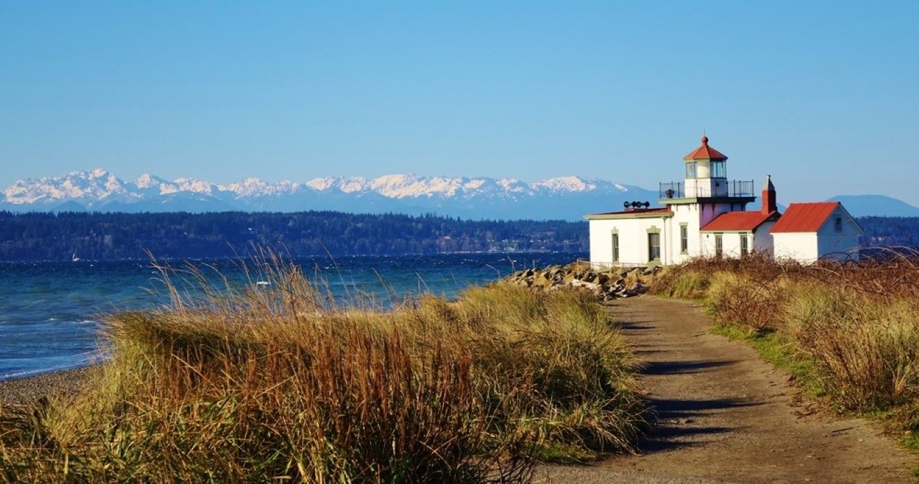
Plan plotted by landscape architect Daniel Kiley—more or less what we see today: testament to Puget Sound’s biodiversity, place where forest canopy meets sea. Plan would create park of 534 acres providing open spaces of natural setting with tranquility not experienced in urban spaces. Natural refuge of meadows, forests, wildflowers, tidal beaches, birds, animals. Also, opening formerly closed post, people would have access to West Point Lighthouse—oldest one on Puget Sound, established 1881.
1973: Senator Henry Jackson dedicated Discovery Park in honor of British sloop HMS Discovery, commanded by Captain George Vancouver during first European exploration of Puget Sound 1792. Naming significant—celebrating “discovery” that was actually re-discovery, European exploration of land long inhabited by Coast Salish peoples. The name reflects colonial perspective while obscuring thousands of years of indigenous presence.
1975: Loop Trail designated National Recreation Trail, runs 2.8 miles through park connecting to other trails. Same year: Voters rejected by 2-1 margin proposal from West Point Golf Association for 18-hole golf course. The rejection reflected public support for park’s natural character over recreational development.
Over years some 150 proposals for all or pieces of park for other uses voiced. Discovery Park held to vision of few intrusions and primary land use as natural setting. Robert Kildall, who succeeded Voorhees as park advocate, protected original concept while achieving notable successes including effective natural screening of West Point sewage plant.
However, Metro West Point Sewage Plant remains controversial—better located elsewhere, critics argue, with area restored to natural marsh with associated access trails and interpretive signage. Largest sewage treatment facility in area is located next to park, near lighthouse and beach. Flood damaged it early 2020s; still not fully fixed. Currently pouring semi-treated sewage into Sound during overflow events—ongoing environmental issue contradicting park’s natural mission.
1989: Donald Voorhees’s death took important park advocate. Kildall, in eulogy, called him “Father of Discovery Park.” 2000: More open space became reality with army’s release of 500 Area block wood temporary buildings. Demolition and reforestation design by Seattle’s Charles Anderson Landscape Architecture added 20+ acres to park.
The Landscape Today: 534 Acres of Biodiversity
Discovery Park’s 534 acres make it larger than New York’s Central Park. Contains 2.8 miles of protected saltwater shoreline, 11.8 miles of trails, unique distinction of being urban park where you experience true wilderness solitude while maintaining views of Seattle skyline and Olympic Mountains.
Forests, beaches, prairies, and bluffs dominate landscape. Visitors traversing might spot barn owl between branches or orca just offshore. Site’s military history hasn’t vanished—historic district preserves some architectural relics—but it’s sideshow to natural beauty. Chapel-on-the-Hill outside Historic District has status of city landmark.
Over 270 different species of birds documented by Seattle Audubon Society. Wildlife is abundant particularly birdlife. At ground level: coyotes, chipmunks, raccoons inhabit woods. Offshore: marine park shelters sea lions and harbor seals. 2009: both lost black bear and roaming cougar spotted in vicinity—then safely relocated outside city limits.
The biodiversity reflects intentional restoration work. Native plant species reintroduced, invasive species removed, forest allowed regenerating naturally, meadows managed supporting grassland species. The work never ends—continuous battle against invasive species like Himalayan blackberry and English ivy, ongoing efforts maintaining trails while minimizing human impact, balancing public access with habitat protection.
West Point Lighthouse located on West Point—westernmost point of park and entire city of Seattle. One of 18 active lighthouses in Washington State. Can be viewed from South Beach Trail. North Beach strip on south side: West Point Treatment Plant almost entirely concealed from marsh, beach, trail—though not entirely successfully.
Elevation ranges from sea level to 280 feet. Annual visitors: over 2 million. Location: Magnolia neighborhood, Northwest Seattle, 3801 Discovery Park Blvd. Park open 4 AM-11:30 PM daily. Visitor center provides maps, information about seasonal conditions, wildlife spotting opportunities, historical context.
Fort Lawton Historic District in heart of Discovery Park contains numerous historic buildings and structures that were once part of fort. Following list includes only buildings and structures surviving at least into 1980s. Several buildings housed officers still exist, converted into single-family homes.
The Ongoing Challenges: Maintenance, Access, Controversy
2005: Fort included in Base Realignment and Closure list. Base Realignment and Closure Commission 2005 determined 70th Regional Support Command headquarters would close. Fort Lawton officially closed February 25, 2012 at ceremony. All personnel living in Capehart Housing cluster left by December 2009, residential area razed following summer. Fort finally closed for good September 14, 2011 when Army’s 364th Expeditionary Sustainment Command transferred operations elsewhere.
2004: City of Seattle announced would purchase 23 (later 24) acres of U.S. Navy property within park. Decision made demolishing structures creating open space. The acquisition added more land but required demolition funding and restoration planning.
Car access to beach area restricted. Required permits obtained from visitor center. The restriction aims protecting sensitive beach habitat while allowing pedestrian access. But creates accessibility challenges for elderly and disabled visitors unable hiking long distances.
Friends of Discovery Park—volunteer organization—staunchly defends park’s natural character against development proposals. Celebrated Master Plan’s 50th anniversary 2022, emphasizing park’s original vision of “open space of quiet and tranquility for citizens of this city.”
Budget constraints perpetually threaten maintenance quality. Seattle Parks Department faces funding shortages affecting all parks but Discovery Park’s size and natural character require specialized management. Trail maintenance, invasive species removal, native plant restoration, wildlife monitoring—all require ongoing investment often inadequate.
Climate change presents new challenges. Sea level rise threatens beach areas and West Point. Changing temperature and precipitation patterns affect forest health and species composition. More frequent extreme weather events cause trail damage and erosion. Adapting park management to changing conditions requires resources and expertise not always available.
The Paradox of Discovery: What Was Lost, What Was Found
Discovery Park embodies paradoxes. Named for European “discovery” that erased indigenous presence. Created from military installation that displaced Coast Salish peoples. Celebrates natural beauty on land that was logged, developed, militarized, then laboriously restored. Honors history of fort where justice miscarried and racial injustice went unacknowledged for decades.
Yet park also represents redemptive possibilities. Land that served military purposes for 70+ years returned to public for peaceful recreation. Indigenous peoples who were forcibly removed gained institutional foothold through Daybreak Star. African-American soldiers wrongly convicted eventually received (inadequate) acknowledgment. Logged landscape regenerated into thriving ecosystem. Military structures converted to cultural and residential uses.
The 534 acres contain multitudes: trails where children learn identifying birds, beaches where families watch sunset over Olympic Mountains, forests where solitary hikers find quiet contemplation, lighthouse that has guided ships since 1881, cultural center celebrating indigenous heritage, historic district preserving military architecture, meadows where coyotes hunt, cliffs where eagles nest.
Discovery Park isn’t wilderness—it’s managed landscape requiring constant intervention. But intervention aims supporting natural processes rather than controlling them. The goal: allowing forest to be forest, meadow to be meadow, beach to be beach—while enabling 2 million annual visitors experiencing those ecosystems without destroying them.
The challenge: balancing competing values and uses. Nature versus recreation. Solitude versus accessibility. Preservation versus access. History versus restoration. The balance constantly renegotiated through public process, park management decisions, volunteer advocacy, political pressure, and ecological realities.
Bernie Whitebear’s 1970 occupation and Donald Voorhees’s legal advocacy both contributed to Discovery Park’s creation. Indigenous rights assertion and environmental preservation aligned—not perfectly, not without tension, but sufficiently creating outcome neither could have achieved alone. Park exists because multiple groups with different motivations found common ground opposing missiles and golf courses, supporting natural refuge accessible to public.
Fifty years later, Discovery Park stands as testament not to single vision but to messy democratic process producing imperfect but valuable results. The fort became forest not through master plan executed flawlessly but through activism, legislation, negotiation, compromise, litigation, renovation, restoration, and ongoing stewardship.
The 270 bird species, the barn owls and orcas, the coyotes and harbor seals, the madrone trees mistaken for magnolias, the beaches where Coast Salish peoples harvested shellfish millennia before Fort Lawton existed—all persist because enough people at crucial moment said: this land deserves better than missiles or golf courses. It deserves becoming what it was, what it could be: forest meeting sea, wildness within city, 534 acres where discovery means not claiming but returning, not conquering but restoring, not imposing but allowing.
The greatest discovery isn’t what Captain Vancouver found in 1792 or what Fort Lawton represented for 70 years. It’s what Seattleites continue finding: that cities can accommodate wilderness, that military bases can become parks, that damaged ecosystems can regenerate, that competing interests can produce shared spaces, and that sometimes the best use of land is simply letting it be itself—forest, meadow, beach, refuge—available to all who walk its trails with respect and wonder.